
Research
My research asks how forests regulate and respond to climate, and why our ability to answer that question depends on how we measure them. Two connected themes run through my work: the science of forest carbon dynamics, and the data infrastructure needed to address it at global scale.
From canopy surfaces to vertical structure
Forest carbon science has long relied on canopy-surface metrics (i.e, spectral reflectance, canopy height, above-ground biomass density) derived from passive optical sensors and gridded data products. These remain fundamental and have been transformative for our understanding of the global carbon cycle.
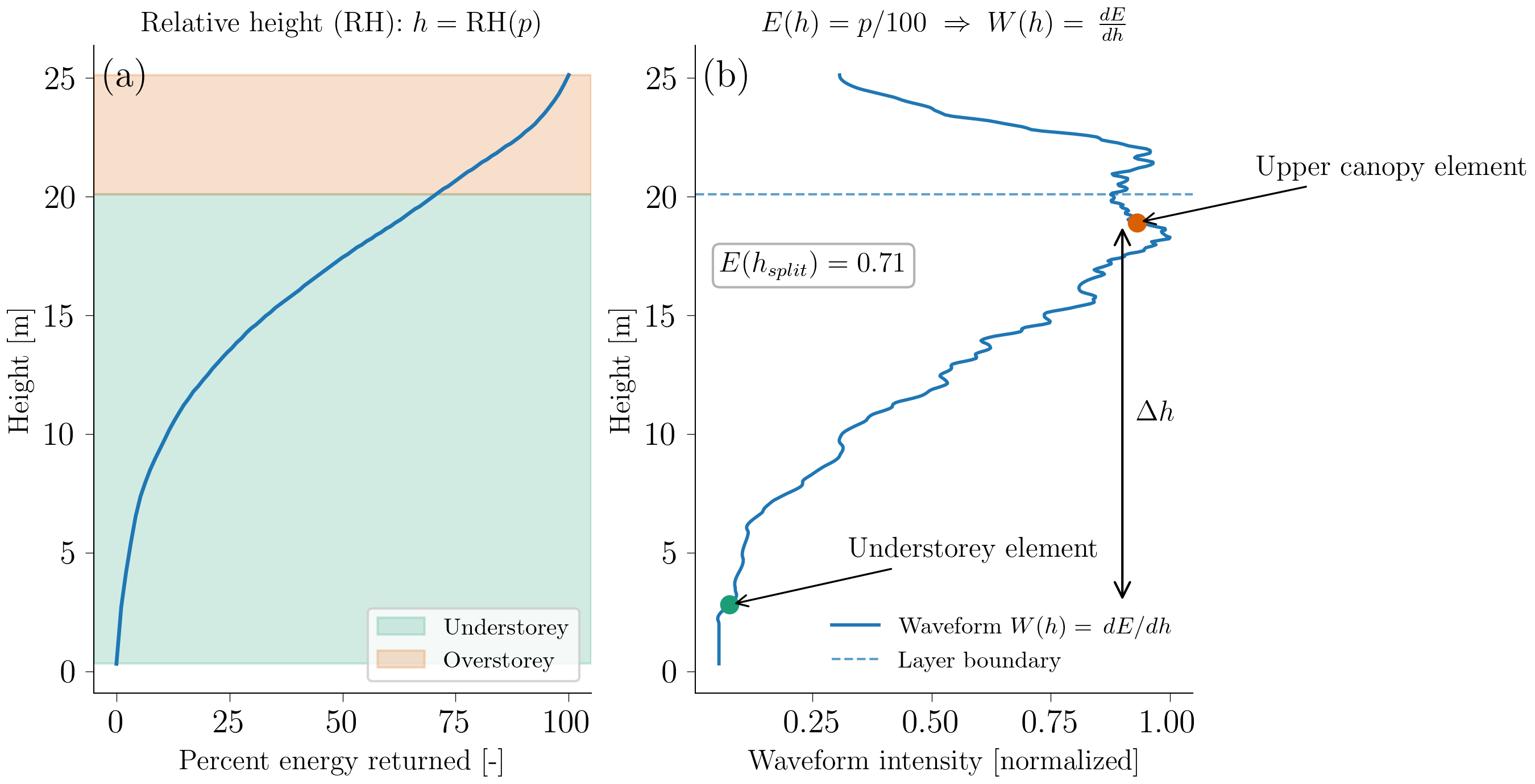
The emergence of spaceborne LiDAR, with GEDI and ICESat-2 now providing systematic global sampling, adds a new dimension: for the first time, we can quantify the contribution of vertical forest structure to carbon dynamics at global scale. Processes that play out vertically (e.g., understory biomass accumulation, sub-canopy gap dynamics, below-canopy recovery trajectories) are particularly important during climate extremes such as drought and disturbance. My research seeks to quantify how vertical structural metrics complement canopy-surface observations to improve our understanding of forest carbon resilience.
Forest age, disturbance, and the net carbon balance
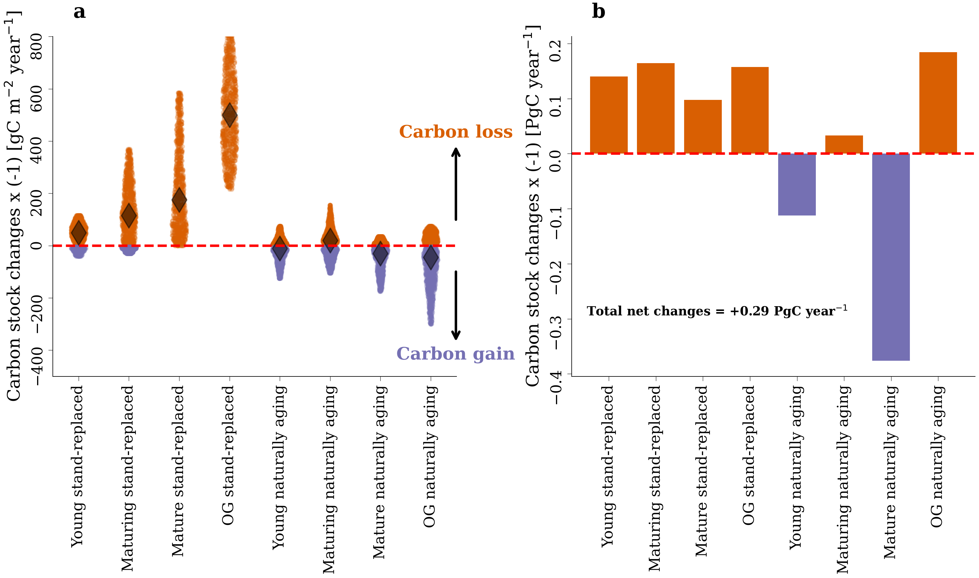 A key organising variable linking forest structure to carbon dynamics is stand age. Using the Global Age Mapping Integration (GAMI) v1.0 dataset and long-term remote sensing records, I investigate how shifts in global forest age distributions co-vary with net carbon fluxes across biomes. A 2025 paper in Nature Ecology & Evolution demonstrates this global covariation. A parallel analysis shows that natural disturbances are increasingly affecting Europe’s most carbon-rich, mature forests (2025, Biogeosciences, in review), with direct implications for the continent’s carbon sink.
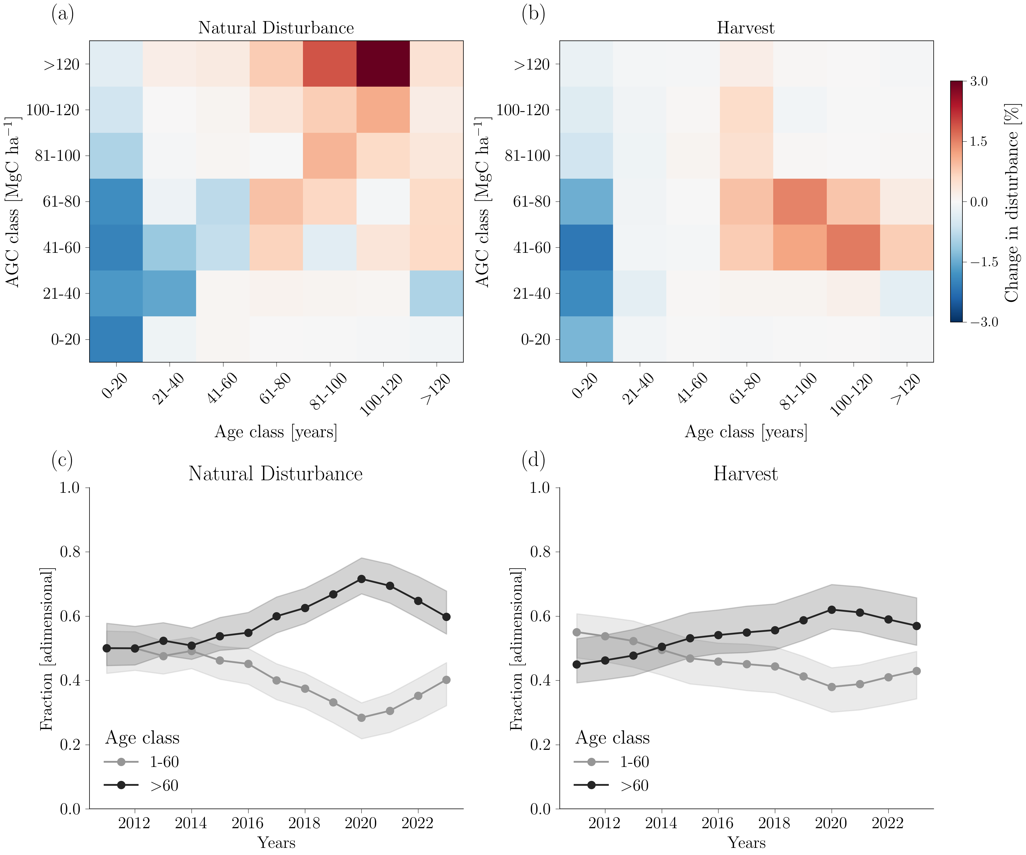
Research data infrastructure as a scientific need
Addressing these questions at global scale requires moving beyond individual gridded products to integrating heterogeneous, high-volume datasets (i.e., gridded EO time series, spaceborne LiDAR point clouds) in reproducible, analysis-ready ways.
To address it, I develop open-source tools and cloud-native data pipelines tailored to forest EO:
- gediDB: TileDB-based toolbox for ingesting and querying the full GEDI L2A-B and L4A-C archive at scale (JOSS, 2025)
- icesat2DB: scalable processing and management of ICESat-2 ATL08 canopy height data
- alsDB: ingestion and processing of Airborne Laser Scanning point clouds
- EO Forest STAC Catalog: unified metadata and cloud-native access layer for heterogeneous forest EO datasets
More details on funded project involvement on the Projects page.