
Data
Global datasets and data products I have contributed to are listed below. Software tools used to produce these datasets are described on the Code page.
[2026] Global ICESat-2 canopy structure dataset
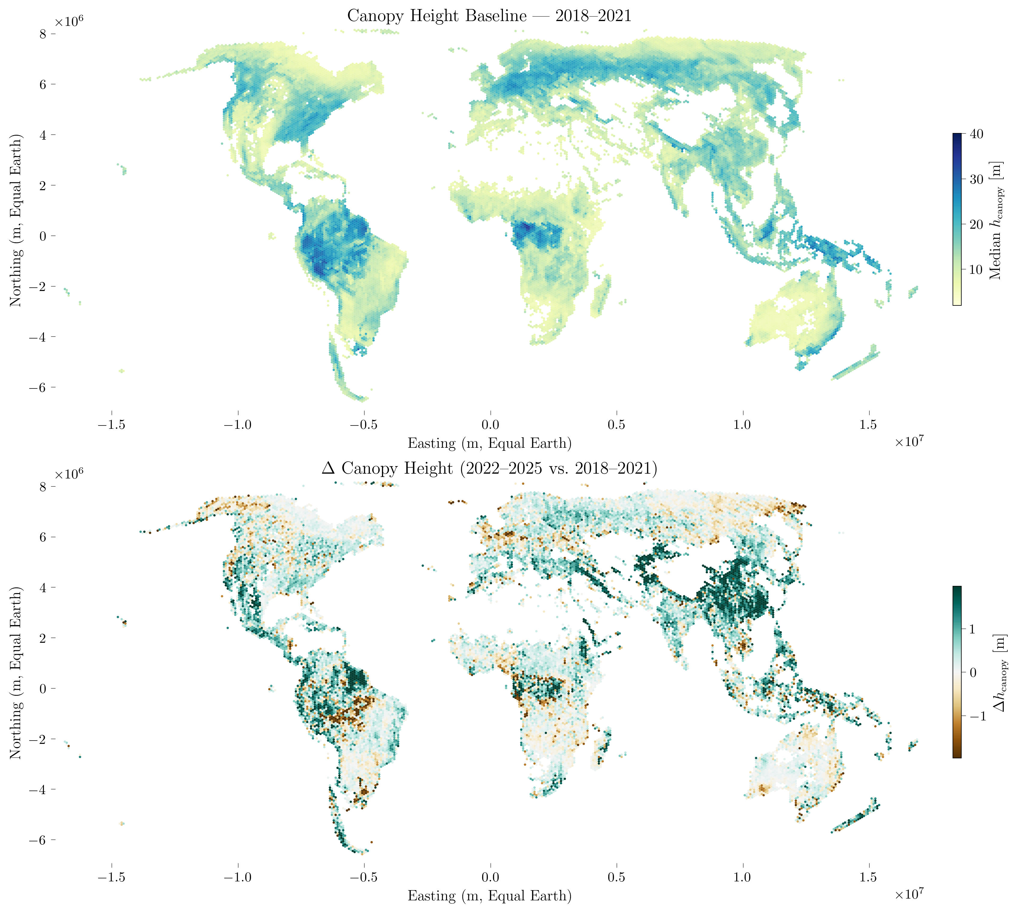 A globally harmonised, analysis-ready dataset of canopy height and structure derived from the full ICESat-2 ATL08 archive using icesat2DB. The dataset provides standardised canopy height estimates at the shot level across all vegetated land surfaces, enabling multi-temporal monitoring of canopy dynamics globally. Developed together with Felix Dombrowski, Mikhail Urbazaev, and Amelia Holcomb.
docs
[2025] Global GEDI forest structure dataset
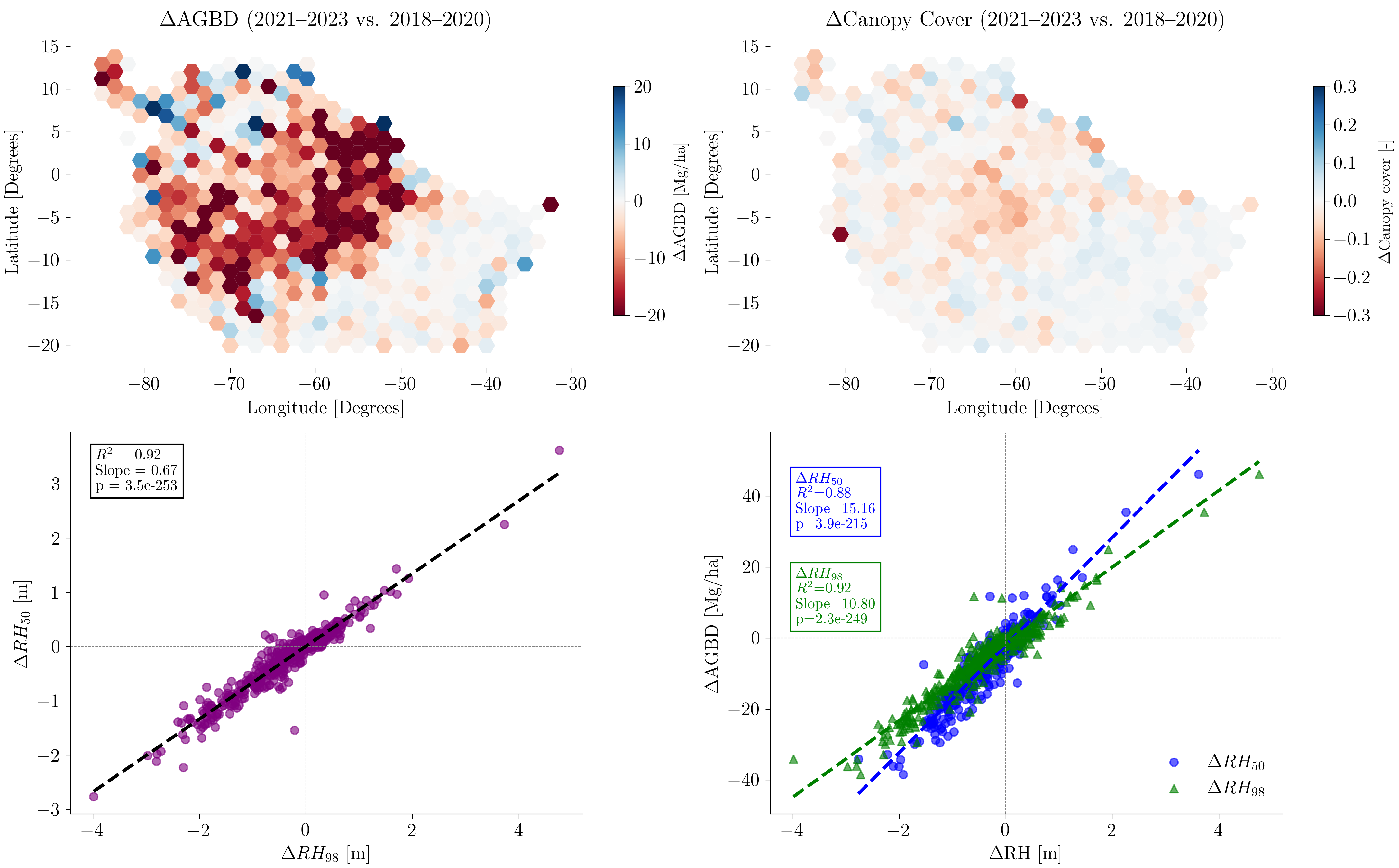 A globally reprocessed, analysis-ready dataset of forest canopy height, cover and aboveground biomass density derived from the GEDI L2A-B and L4A-C LiDAR archive using gediDB. Enables large-scale monitoring of forest structural changes, including disturbance and recovery dynamics. Published in the Journal of Open Source Software (2025).
paper
[2025] EO Forest STAC Catalog
A STAC-based unified metadata and cloud-native access layer for heterogeneous forest Earth observation datasets hosted on GFZ S3/Ceph infrastructure. Enables interoperable, analysis-ready access to multi-source forest EO data.
catalog
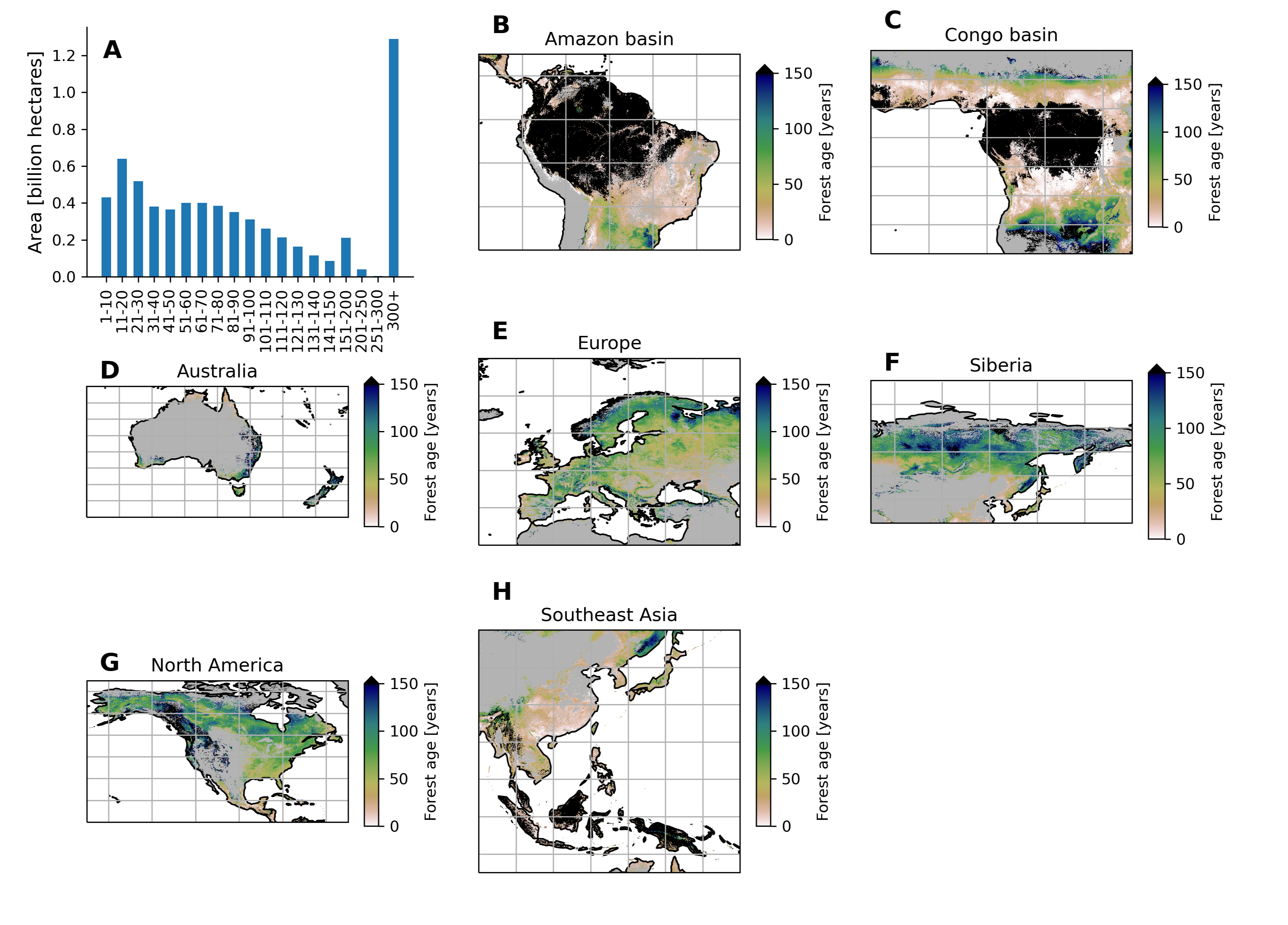
[2024-2026] The Global Age Mapping Integration (GAMI) dataset
The GAMI dataset provides global forest age distributions at 100-metre pixel resolution, estimated using XGBoost trained on over 40,000 forest inventory plots, biomass and height measurements, remote sensing observations, climate data, and Landsat-based disturbance history. The dataset has been progressively updated across multiple versions (v2.0, v2.1, v3.0, v3.1). Data are accessible via the EO Forest STAC Catalog.
[2022] The FluxnetEO dataset
Quality-filtered and gap-filled Earth observation data from MODIS and Landsat at 338 Fluxnet site locations. Version 2.0 features MCD43A4/A2 and MxD11A1 MODIS products and Landsat Collection 2 Tier 1 and Tier 2 products within a 2 km radius of each site, covering surface reflectance, vegetation indices and land surface temperature. Openly available for Landsat and MODIS.
paper
[2021] The MPI-BGC forest age dataset
 Global distribution of forest age as of around 2010, produced using a machine learning approach trained on over 40,000 forest inventory plots, biomass and climate data.
data | paper